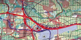
If you want to plan the region sustainably, you need reliable data and information from a wide variety of areas. As early as 1997, the regional assembly decided not only to collect this information, but also to present the large amount of geographical and statistical information in a structured and comprehensible way.
RegioRiss is based on the geographical information system (GIS) and visualizes links in the form of cartographic representations, satellite and aerial images. In this way, similarities, interdependencies and relationships, but also spatial conflict potentials can be made clear and vivid.
The analytical and combinatorial functions of the system, together with the visualization options, provide efficient support for numerous planning and decision-making processes in the Verband Region Stuttgart.
The Regional Spatial Information System contains all WebGIS applications that were created on the basis of RegioRISS data. These include, for example, WebGIS applications for temperature, bioclimate, landscape assessment or the road and rail network.


![[Translate to English:] S-Bahn](/fileadmin/_processed_/3/d/csm_058_-_S-Bahn_Stuttgart_ho___ehengleicher_Einstieg-1-rwilling_ce82cb0b0e.jpg)


